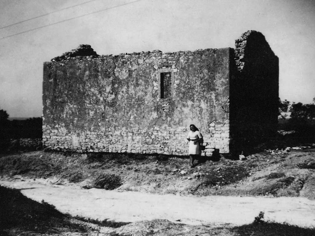

The oldest known church consecrated to St Martin was situated on the eastern approach to Vrsar, on the northern side of the Vrsar-Gradina road, on a plot with the surface area of 65 m2, which is still owned by the Parish of Vrsar. It probably belongs to the group of Romanesque churches, and is mentioned on the map drawn by friar Mauro in 1540. The last remains of the church disappeared after 1945.
The oldest known church consecrated to St Martin was situated on the eastern approach to Vrsar

It probably belongs to the group of Romanesque churches, and was mentioned in 1540. In that historical document, the church is marked by a pictogram in the shape of a cylinder with a cross.
The church was recorded in the 1820 Franciscan Cadastre, and the cadastral plan mentions agricultural surfaces called St Martin in its surroundings. This, as is the case with St George and St Andrew, suggests the existence of a brotherhood that may have been attached to it, and that owned the aforementioned properties. Prior to World War II, the church was unfit for liturgy – without a roof and partially ruined, but the walls were still there in their full height.
A photograph of the church taken soon after World War II and kept in the parish house in Vrsar shows that the entrance into the church was on the western side, that there had been a bell-cot on its façade (the bell-cot did not exist any longer at the time when the photograph was taken) and that it probably covered the entire plot owned by the parish. The floor plan of the church should thus be sought in the contours of the aforementioned cadastral plot. The last remains of the church disappeared after 1945 since they were used in the construction of the road toward Gradina, which stretches along the very boundary of the plot where the church building once stood. There are no more recent records or bibliography on the church; therefore it is unknown in general terms, and in professional and scientific circles.